
Niner
METAR & TAF · iPhone
The five-second preflight glance.
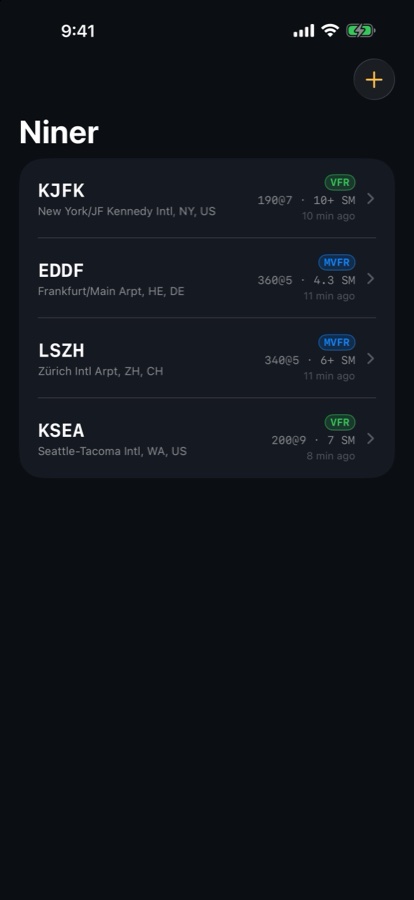
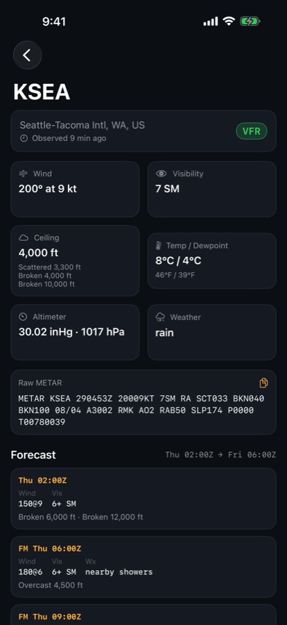
Decoded METARs and TAFs for the stations you care about. Flight category at a glance, raw text one tap away, the last report cached for dead FBO Wi-Fi.
VFRMVFRIFRLIFR
Free
Two stations
Everything decoded: wind, visibility, ceiling, temperature and dew point, altimeter in inHg and hPa, headwind and crosswind per runway, density and pressure altitude, sunrise and sunset, nearby airports from your location, a home-screen widget, the full TAF timeline, raw text, offline cache. No ads, no account.
One small unlock
Niner Unlimited
Track as many stations as you like, forever. One purchase, no subscription. Nothing else is paywalled.
Data from aviationweather.gov (NOAA); runway headings from OurAirports. Not for operational use. Always get an official briefing.